Showing posts with label tamilnadu. Show all posts

Saturday, June 4, 2011

Palamalai - the Quaint little hilltop temple

Quite often we plan and go to so called exotic and extravagant places, yet we fail to discover and see great gems of places that are right next to our backyard. Palamalai, some 25 Km from my hometown Coimbatore is one such beautiful place. Visited only by some regulars of the temple, not many in Coimbatore visit this place, if at all they have even heard about this place. Palamalai is a quaint little village atop a hill about 25 km from Coimbatore, and is known more for its temple - Arulmigu Palamalai Aranganadhar Thirukkovil, (A Perumal (Vishnu) Temple) than its hilly locale. I have heard that the route was bad, but when I had visited – June 2011, the road was freshly laid, and was in best shape. The road can take you right upto the temple and you need not walk any further.

The route is as follows : Coimbatore ==> Mettupalayam road ==> Periayanayakan pirivu ==> Kovanur ==> Palamalai

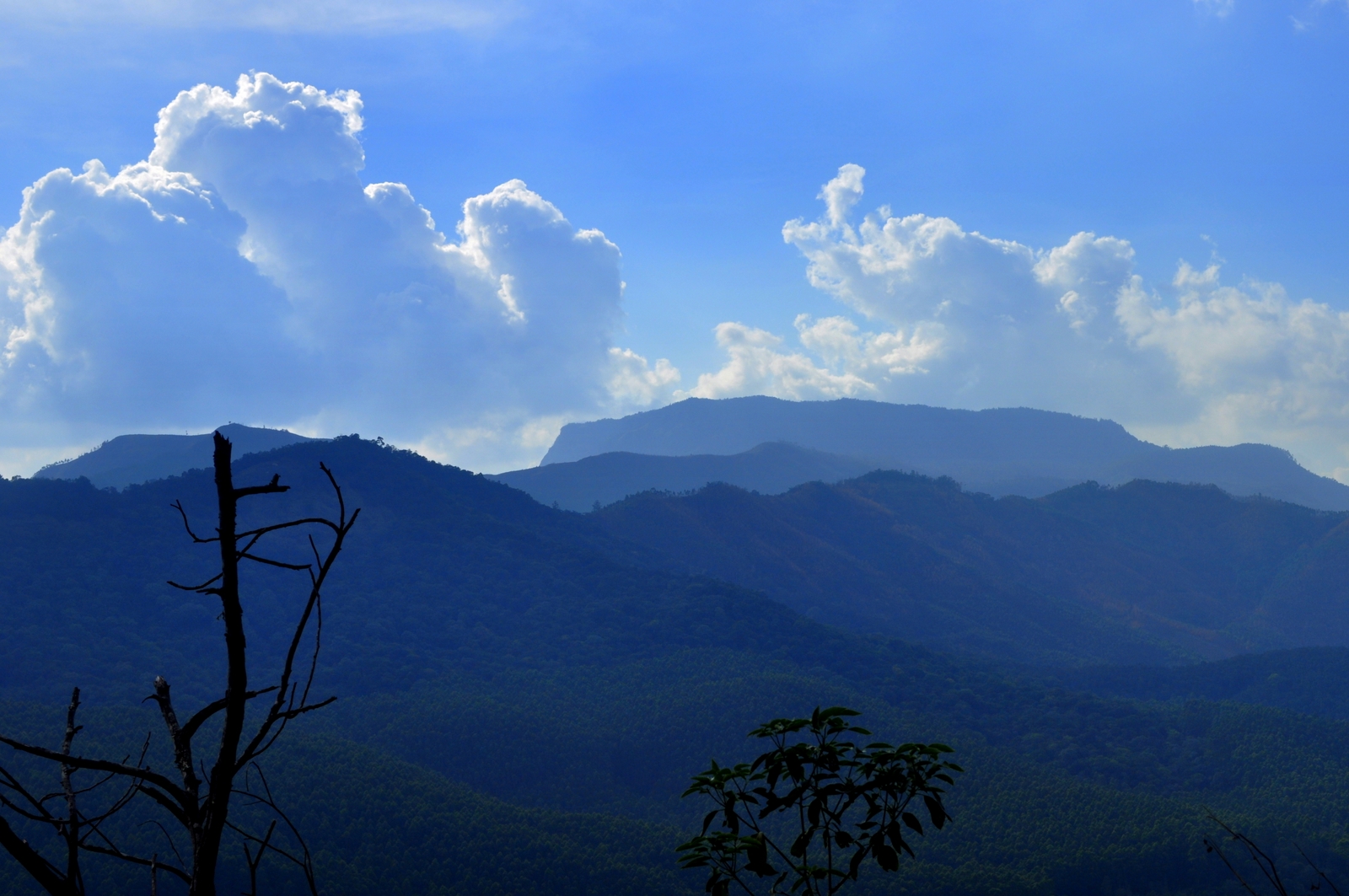
After Kovanur, there doesn’t seem to be any human inhabitation and the roads are completely empty and peaceful. The road atop the hills is very good and even had a few hair pin bends on the way. After some 6/7 Km of winding hill roads amidst some scenic views, I reached the Top of the hill.


Route from coimbatore to Palamalai:


View Larger Map

The top of the hill reveals the large temple, nearby tea shops, and a few boys playing cricket with a bunch cut coconut tree branches.  At the top, you get fooled that the entire place is just about the single Temple which forms the central pivot of the place, though it is true, there is also an entire village that came after a ride down the road a further 1 Km. However we rather parked our bike at the temple and walked about on our foot to discover more. 

Farmyards along the way

Road near kovanur

Farther from Kovanur

Snapped En-route


Empty road stretch

Hair pin bend no 1

Viewpoint along the way

Cricket alongside temple

Bike parking area..!


Path to Theppakkulam..

The Theppakkulam

Near the theppakkulam

House along side the village

Lake near the village

MGR's midday meal hut
Whers my Midday meal...!


village backyard

yet another viewpoint
We enquired a few villagers around. We heard that there is a Temple pond / ‘Theppakkulam’ once you go down a small path behind the temple. A walk down this path for about a Km took us to this rather deserted and beautiful theppakkulam amidst thick cover of trees. We further ventured ahead towards the villages and small settlements and were surprised to find a beautiful lake alongside as well. The settlements were completely serene with hardly any one around to be seen. There was even a small elementary school with barely 10 students, we saw more of them infact queuing up for the free midday food than any class at all. A complete roundabout walk around the village lead us back to the main temple. A brief visit inside the temple gave a glimpse about the its history, where all we could find was that the temple was quite old and full of stories, hinting that it would be a must visit place for any ardent temple visitor. Further walk lead us to few more view points for our cameras. The local tea shop nearby served hot and spicy ‘black ginger tea’ (sukku kaapi !) which went just right with the Ragi thattu vada. This was the only place I have seen Ragi vada which tasted very good indeed.

After spending about 2.5 hours exploring the place we started back having spent one of our most satisfied and peaceful time of our lives.

Monday, January 10, 2011

Hogenakkal Falls, Tamilnadu

Info: Hogenakkal Falls is a waterfalls across the River Cauvery in TamilNadu. The place has numerous waterfalls as the river cuts the river rough a rocky terrain. The falls and river can be best seen along a coracle ride. Freshly caught and fried fish is a must have at hogenakkal. The place is around 120 km from Hosur and is very much frequented by tourists. Hogenakkal falls/river was shown beautifully in the movie Roja in the Chotisi Asha song.
Distance: 160 from Bangalore. 120 Km from Hosur, 
Accessibility: A one day trip would be sufficient, either by car or bike. There is not much to do at hogenakkal - stay is not recommended. Buses will be crowded and takes a longer route:  You should change 3 buses in case you are going by bus: Bangalore (Kalasipalayam/Madiwala water tank stop/Silkboard) to Dharmapuri/Hosur, Dharmapuri to Pennagaram, Pennagaram to Hogenakkal. Sometimes you may be lucky to get a direct bus from Hosur itself.

Best time: Post Monsoon (Aug to Feb)

Route from Bangalore: There are 3 routes that go to Hogenakkal from Bangalore. The first 2 routes are usually known and the 3rd route below is not heard of much. 

1. Main Route (165 Km): Bangalore => Hosur => Rayakottai => Palakkodu => Pennagaram => Hogenakkal -> 2 lane road, roads are very good as on date.


2.Highway (183 Km): Bangalore => Hosur => Krishnagiri => Dharmapuri => Pennagaram => Hogenakkal -> 4 lane highway. Road is awesome

3. Hilly route (123 Km):  Bangalore => Hosur => Denkanikottai => Anchetti =>Hogenakkal -> 2 lane and good condition till Anchetti, Almost single lane from Anchetti. Road is pretty bad for a stretch of 15 Km.

Route Details:
Main Route

View Larger Map 


Highway route:


View Larger Map


 Hilly route:

View Larger Map

 
Time spent at spot:
Unlike
many other falls hogenakkal is a place where we can actually spend more time than just taking bath. The following are must at Hogenakkal.

  1. A ride in coracle along the gorge, underneath the falls
  2. A swim and a dip in the river
  3. Full fledged bath in one of the falls
  4. Exploring the falls along the rocks
  5. Having freshly fried fish
Travelogue: 
Right when we started planning our trip, only concern was the distance from Bangalore was around 170 Km one way and  3+3 = 6 hrs biking on a single day would indeed be difficult. Six hard hearted brave souls turned up for the trip and we started at 6.30 am from Bangalore. The idea was a leisurely onward bike trip along the hilly country side road (Bangalore => Hosur => Denkanikottai => Anchetti =>Hogenakkal)  with lots of stoppages and photo snaps. And return from Hogenakkal via the main route. Winter morning was extremely cold and misty in the morning till we reached Denkanikottai. A Right turn from Hosur at a signal just before the main over bridge of Hosur was the diversion towards Denkanikottai. Roads were very good from Hosur till denkanikottai, will lots of green beautiful grasslands along the waysides. We reached Denkanikottai at 8.15 am and had quite a satisfying breakfast at a small hotel in Denkanikottai - a plate of idli, vadai, dosa and pongal. 

The road from Denkanikottai till Anchetti was even better for a biker: Nicely laid tarmac without any patches with highest level of traffic being an odd bus, going past and stretches of farmlands, grasslands , rocky mounts, and country side houses along the route. Just a few Km before Anchetti was a brief hilly stretch with a 3 or 4 hairpin bends with nice views along side. After Anchetti the roads turned a bit patchy but the route was quite good and greenish with a lot of villages crossing by along the route.We stopped quite a few times for some pictures of roads, a wayside pond with lotus blossoms, a south Indian Temple etc., After riding for an hour we reached close to Hogenakkal and were able to hear the roaring Cauvery towards our right side. The road was parallel to the river for around a 4 Km stretch till Hogenakkal. 

At Hogenakkal we headed straight to the Coracle (or 'Parisal -in Tamil') ride, Being a holiday , boats were in big demand, we managed to bargain a rate of around Rs 140 per head with 6 of us on board. The guy took us to underneath few of falls and a ride along the free flowing river. An amazing aspect of the ride was that the land at one side of the river was Karnataka and the other side was Tamil Nadu. He took us to a nice easy diving spot in the river where we had a good swim for sometime. He also went along the other side of the bank - the Karnataka side where he stopped so that we can have some rice with Fish curry right from inside the boat. After a 2 hour stretch he dropped us off near one of the falls where we went and sat under the hard hitting water for sometime for a nice bath. We also savoured good eatables from wayside women vendors selling butter milk, boli (sweet chapthi like dish), fried fish etc., Dried, tanned and tired we weren't sure if we can cover another 170 km in bike back towards bangalore. We started at 4.30 pm along the main route (1st one in the list above). The road was a very good 2 lane but as we passed Rayakottai,  things started getting dark and it was a night mare to drive a two wheeler at night. I would recommend this route only if you start early enough to reach Hosur before night fall. The highway route would have been better as we could have helped to a CCD or kamat or Adyar Ananda Bhavan which are located along the highway. After a 3.5 hour drive, reached Bangalore at 8.30 pm.
 

Onward route - before Anchetti

Onward route - near Anchetti

Anchetti to Hogenakkal road

Village Past Anchetti

A pond along side


South Indian Village deities - Protection guard at Village entry


Pictures at Hogenakkal: 


Shop on coracle


Sunset - return route

Monday, May 17, 2010

Munnar to Kodaikkanal Trek

This had been one of our dream treks and got lucky that one of our Bangalore based trekking club got permission for the route. Obtaining permission is quite difficult owing to the fact that the trek ranges along restriced areas of both Kerala and Tamilnadu and most the trek route would be along the border of the states.
Trek Reference: http://trekwiki.wetpaint.com/page/Kodai+to+Munnar


Misty morning at peak


Village where we ended the trek


The plan was to cover the trek with in 2 days which would be difficult to squeeze since the ideal time to cover the trek would be 3 days. So we had to cover a distance of 35 (15Km on first day and 20Km on the next) within two days. We had started towards Munnar Friday night and got to reach Chinnar at 7 am the next day, where we first encountered the Kerala border check post. The guide joined us there and we went along the picturesque road towards Munnar. We had a great breakfast (Appam and Puttu-kadala curry) at a place called Marayur inside the Kerala border on way towards Munnar. The highway route was amazing with beautiful tea estates and gorgeous valleys. Much to our dismay we reached the starting place of our trek, the ‘Top Station’ only at 2 pm on the day. However on the way were wide stretches of tea estates, beautiful lakes, two amazing dams, Mattupatty dam and Kundala dam that offered amazing landscapes for some of our wannabe photographers.

The Hut where we camped


Indian Gaur (Wild Indian Bison)

After some formalities with forest officials we started towards our camp site, a forest ranger hut located at about 5 hours trek from the Top Station. We were quite lucky to spot a Tusker along the route. We also got to see a giant squirrel and a Black monkey along the trek route. The camp site would be at 2400 m, along one of the ranges of Anaimalai hills. Along the route we went across to cover the second highest peak (2600 m) after Anaimudi peak (2695 m) which is Indias’ highest peak apart from the Himalayan ranges. The sunset atop the peak provided scintillating views, with the ranges of hills stacked across a misty backdrop. This had been by far my highest point in trek and perhaps the best.

The lonely forest hut perched atop one of those ranges where we were to stay was completely remote, without power and any sort of communication and with an indimidating forest outside teeming with wildlife. It was very cold and the camp fire that we set outside our hut saved us from shivers. Our generous guide cooked us some puliogare and we had our camp fire there.

The morning was very misty and sunrise atop was amazing. After attending natures’ call at a nearby stream and having a hot soup, we started the arduous trek. The trek would be along the border of the states for most of the route.

The route offered us plenty of view points looking upon the misty peaks and ranges and at some spots the guide informed us that the view down, would show speckles of buses and villages near the town Kambam/Theni/Boady. There were quite many streams down the route and a few check dams where we could replenish our water bottles. We prepared our lunch of MTR ready to eat at one of those spots.

We got a glimpse of an Indian bison (Gaur) upclose at one of those check dams looking stark down at us. After taking some quick snaps before it would start charging at us, we moved on along. Owing to great heights of the peak, most of the vegetation was pine trees and offered us beautiful glimpses of pine forests all across the valleys. Our trek veered into Tamil Nadu and our destination was a small beautiful serene village adorned with picture perfect landscape of step farming down the mountains.The village was called Kilavarai where our cab would wait for us and was about 45 Km by road from Kodaikkanal. We headed to Kodaikkanal for dinner and some bit of shopping.

This had been my most fulfilling trek till now not that it showed the serenity, and the abundance of freshness and untarnished life at these uninhabited forests but it showcased how man can completely erode the simplicity, and the orderliness of the place where he goes and muddle it up to ravish the place to an irreversible extent. More of my thoughts and treksperience at
http://disentangled.blogspot.com