Sakleshpur Railway track Trek
Donigal > Yedakkumari > Subramaniya road.
Reference:
http://usandeep.com/trekking/sakleshpur.html
Sakleshpur trek aka 'Green route' trek had been a dream route for all trekkers, and remains at top in the list of 'treks to be done' for any trekker in Karnataka. And the hype didn't prove wrong at all.
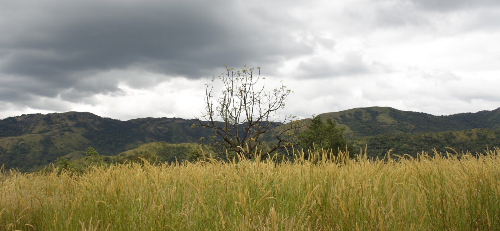
We had company of a random group who had planned the trip in orkut. We started towards, Hassan in a cab, and had our break fast at 6.30 am in Sakleshpur. The starting point of our trek was at an abandoned railway station at Donigal, which comes along NH48, on the highway from Hassan to Mangalore. The entire railway track is along the western ghats and interspersed by numerous bridges covering valleys and streams and also dotted with around 45 tunnels.
We started from Donigal station in the morning to reach the first-day target of Yedakkumary railway station. The bridges were very intimidating, the wooden ridges spanning across the rails had a lot of gaps between them and a small slip would take us all the way down the valley. And off course the intermediate trains that come along make the situation worse, we got to be careful and listen to sounds of train before going ahead along a bridge or a tunnel. Till Yedakkumary we had to cross from tunnels no 5 to 18. Each tunnel were from 100 m upto 600 m and impossible to walk without a decent flash light. All most half the distance were covered with bridges and tunnels and offered a number of scintillating views down the stream and valleys.
We lived through the beautiful landscapes and track views that had come in famous Maniratnam Tamil movie 'Thiruda Thiruda' most of which was shot along this track. At around 12th tunnel there was a beautiful water falls and stream and had our bath there. We lighted up a small fire and prepared our MTR ready to eat and had our lunch at the same place. We continued further and after about an arduous 16 Km, and after 18th tunnel which was an agonizing 488 m of darkness, at 6.30 pm we could see the platform and the board spelling Yedakkumary railway station.
We spent the night at the platform and had our sleep on a sleeping bag.
The next day we were supposed to trek along the track till Subramaniya railway station, however owing to lack of food supplies we decided to take the track down the forest towards the highway in the middle of the track. The lone station master present at the railway station offered us some advice to take a short cut right from the railway station through thick vegetation which should take us to the highway with a 4 km trek.
The Lost Saga:
But half way through the trek we realized we were lost in the woods. We were stranded in the middle and every direction we took either ended in a narrow ridge of streams or stopped abrupt at a plunging valley. In spite of GPS and trying to decipher the sounds of trains in tracks, after about 3 hours we were not even able to trace our way back. Adding to the panic were numerous leeches, which started infesting all of us. As I would stop to remove a leech in my one leg, another two would scale up along my other leg. Each of us got infested with more than 10 leeches and got numb of leech bites after 3 hours.
At about 1 pm, we had almost given up and were resting near a stream, when we heard a sharp train sound. One of us ran towards the sound which was upstream and yelled out big time, telling us that he was under a railway track bridge. We had a relief of our lives. With some risk we climbed atop the bridge along the sides and were relieved to see that we were back in track but were back at the 16th tunnel infact in front of Yedukkumary station. All we had had over the day was a single apple, and had nothing left. What we had infront of us was a long and fast trek towards the highway.
We did everything but bashing the station master, and started along the track.
We found couple of small trams carrying some of the workers/inspectors and work was on progress to upgrade this track into a functional broad gauge. They helped us through the routes and at about tunnel 35 there was a path to right which we had to take to reach the highway. After about 7 km along this way through a path down the forest, we reached the Kempuhole river at about 6pm crossing which would take us to the highway.
One of us got a mobile signal and called up the cab driver to come the exact spot in the highway.
The river was flowing wild and almost shoulder deep. On top of that we saw a guy from opposite side shouting at us to cross fast, informing us that water would be released from the dam any time soon and the level of water would only increase. With a life threatening situation looming at us, we managed to straddle across the water in a chained fashion, with a few of us loosing our mobile to water and current. With huge relief and lots of thanks to God, we were back at the highway where we waited for the cab which would take us safely back to Bangalore.
Sunday, September 6, 2009


Wednesday, August 26, 2009
Exploring Jog and Sharavathi...
A visit to jog had been beckoning ever since we had come to Bangalore
We had timed our trip at mid August which would be the peak rain season so that we could witness jog at its full glory. Shimoga greeted us with cool showers, and the weather remained as such during our entire trip with mild showers all along. Buses to jog were right outside the train station and we boarded one straight away. The route all along towards jog was beautiful with paddy fields and greenery encircling the region, and fine showers accentuating the beauty. The different falls had peculiar names Raja, Rani, Roarer and Rocket and we covered all these.


It took 3 hours to reach the place. We found a youth hostel just outside jog entry gate and booked rooms. I have to admit the rooms were very ordinary with unattached toilets. We didn’t get a booking at KSRTC guest house which was close to the falls, as it was the peak season there.
We started towards jog, and found a taxi man near the entry who offered us to take a small guidance tour to the top of the falls, power house etc., and we took his cab.
We headed for the crest of the falls and came around the tip of the roof of the falls and had glimpses of the crevasses down which the waters take the 600 feat leap towards the ground. The views were simply breath taking. The place was just around 2 km from the main jog falls area and could be reached by walk. The guide then took us to the small power station. He also found us a nice hidden spot with flowing water falls and stream where we spent some time bathing and playing in water. After a terrible lunch at a hotel near the jog we headed to the main jog falls and took a walk around the region with the place offering plenty of sceneries for landscape photography.
We headed down the intimidating 1000 steps to the bottom of the falls. As we reached the bottom, we could feel the mild breeze of water splashing around bouncing off in a gusto off the rocks on its fall. Cameras were troubled with water droplets and we had managed to take only a few snaps here and there. The noise and the atmosphere was absolutely enthralling and we even witnessed a small rainbow at the bottom where the waters touch the ground. A whole day to cover jog falls was well justified.
The next day we started by the first bus at 5.30 am towards Sagar in the morning, the plan being a visit to the Chowdeswari temple at Sigandur. We boarded another bus towards Sigandur. The ride tooks us around 2 hours and we were at the point where we had to board a ferry to reach the island amidst Sharavathi river. Sharavathi river was full with torrential pours stretching its borders and banks. The ferry ride was very crowded but still offered a beautiful glimpse of the great Sharavathi backdrop. After a brief visit to temple we came back in ferry and took a bus towards Sagar.
What we missed.
Owing to lack of time and transport facilities, we had to miss out on Lingamakki dam and Sharavathi backwaters stretch.
We compensated by a short visit to Rameshwar temple which looked very old and we were its only visitors, at a village which was around 8 km from Sagar town and and seemed to be least inhabited.
Then we started back towards Shimoga. We also spent some time at a Tiger safari which was around 5 km from Shimoga town on the way and got to spot some tigers and deers. We had our dinner at Shimoga and boarded the train back to Bangalore
Friday, August 7, 2009
Vellingiri / Vellliangiri hills trek - KonguNadu - Siva Temple - Coimbatore
Region : Velliangiri Hills, Coimbatore Region, Tamil Nadu
Peak Height : 2240 meters / 7349 ft
Vertical Climb Height : 1200 meters / 3937 ft
Peak Height : 2240 meters / 7349 ft
Vertical Climb Height : 1200 meters / 3937 ft
Difficulty level: Moderate to Difficult
Vellingiri is located along the westerns ghats and can be reached from the well known Coimbatore region (Kongu Nadu). It is more famous for Lord shiva's temple on top of the peak. The speciality is that the Linga is naturally formed and is within a cave atop the peak and is surrounded by 4 other lingas. And hence called 'Panchalingas'. For devotees the experience of reaching this place is similar to the 'Amarnath Yatra' of the North. Similar to Amarnath, here too Lord Shiva personifies in the form of Linga inside a natural cave. The place is also called Dhakshina Kailash. The cave can be reached after crossing seven hills (literally).
This was in my 'to do' list for a long time, just because the place was barely 50 kms from my house in Coimbatore and because it was located along the beautiful Siruvani hills of the western ghats near Coimbatore adjoining the Kerala Border. Less known for trekking and more known for the Holy Temple, I was amazed by the mystic peaks along this trek in its route. This turned out to be better than most of my other treks, in terms of sheer 'will' to reach the peak after a stupendous steep climb as well as for providing stunning views along the trek across the Siruvani Dam, and other Anaimalai hill peaks.
The trek is very steep and not suggested for first timers.
The base point of the trek starts from Poondi a temple place, near the famous Isha Foundation, which can be reached along the Siruvani Road from Coimbatore.
Coimbatore => Perur Road => Siruvani Road => Poondi Road => Poondi temple
The trek is gruelling and takes a lot of 'will' to get it done with in a day. We had wanted to complete this trek within a day and hence started in the early morning.
There are buses to Poondi, every 2 hours, from Coimbatore- Gandhipuram town bus stand. There is one starting at 6.30 am in the morning. We got on to this bus and reached Poondi at 8 am along the picturesque route of Siruvani road. There was a small mess near the temple at poondi, where we had a light break fast idli -vada. After some blessings from the temple, we started our climb at 8.45 am, along the steps upward which were located at the right of this temple. The trek would not need any Guide as the foot path along the peak was quite evident, moreover there were no other prominent diverging routes along the trek.
Trek route and points:
View Vellingiri trek in a larger map
There were a few devotees who joined us and were walking bare foot making us guilty for wearing shoes.But we were really amazed to see them romping ahead much faster than us in just bare foot. They later confirmed that they were regulars and visit every 6 months. The climb went on and the steps seemed endless. For an hour or so, the steps were along thickly covered green forests. Though it was a warm day, we didnt feel hot, as we were gaining height and the dense tree cover providing good shade.The steps were literally endless. After 1.5 hrs the steps started disappearing and got to know that we had crossed 2 hills/peaks.
A landscape of views across the valleys started appearing along the path. The path was usually along the tip of the peaks and the entire way along had stunning misty covered valley and peaks. The sheep steepness really started challenging us as we progressed along 3rd and 4th hills. There was a small stream down around at this place where we refreshed ourselves. As we progressed further, we could see the views down towards Siruvani dam. But before we could take any pictures, mist covered the place, and was quite thick covering the entire region.
After 3 hours we were barely at the 5th hill (our devotee friend kept counting the peaks that we crossed). And we could feel the wind getting cold and the mist getting thicker. There were some small lingas and temples along as we proceeded and we could see a few long bearded 'Sadhus' / Swamis either sitting calmly or walking towards the peak. Near the 6th peak one of the sadhus in a hut offered us hot plain Rice porridge that tasted heavenly owing to the hard climb and hunger. He did not accept any money and with a heavy heart we proceed further. At 12 we could see the peak atop. The last climb was ever more steeper, and took us another hour to reach the peak. We had taken 4.5 hours inspite of being strenuously brisk and fast all along.
The peak was indeed stunning, the views covering parallel endless peaks across. The peace at the temple was even more serene and we literally meditated for an hour at the peak. The place truly felt like 'God's Abode' We had the little food what we had brought (cakes, fruits and chocolates). We had to miss out on the sceneries as most of the places around were covered with mist. At 2.30pm with a heavy heart we started down the hill. The descent took almost the same time owing to the steepness and the fact that on the way down we had to be more careful not to over stress our soles and twist our ankles. After taking a lot of pictures in a mobile cam, we strolled down briskly.
We reached the base at 5.15 pm however the last bus to the town was only at 6 pm. We could only get a cup of tea at the temple down and waited for bus to go back to Coimbatore.
Pictures from a 2 MP mobile cam:
We reached the base at 5.15 pm however the last bus to the town was only at 6 pm. We could only get a cup of tea at the temple down and waited for bus to go back to Coimbatore.
Pictures from a 2 MP mobile cam:

 |
| Lingas along the peak |
 |
| One of the temple atop the peak |


 |
| our resting place at the peak |

 |
| At the peak - amidst the cloud |

Wednesday, May 6, 2009
Coorg, Madikeri and Tadiandamol Trek
Our trip to visit Coorg was again unplanned and we had in mind to cover both tourist spots as well as finish a good trek in Coorg.


The Malknad Palace enroute to the start of the trek.
Our trip was initially planned for 3 days, however we reduced it to 2 days as we were able to cover most destinations with in those 2 days.
Our trip was on May - first week, so it was peak summer and it was as hot as Bangalore Bangalore via Mysore
Abbey falls:
This was a big disappointment, the biggest being the fact that people are restricted to enter the water in the falls. We spent a mere 30 minutes at this spot.

Dabare forest:
This is a place where they train and nurture elephants and is a river side place where they offer rafting (in still water) as well. Not very interesting again.
Nisargadhama:
This place was similar to a park with lots of scenic places to pose for photo shoots.

Kushalnagar – Tibetan temple:
This is an interesting place, a Tibetan temple with Buddhist monks and presents a place that looks like a Chinese temple out of the blue from an all Indian surroundings.


Raja Seat: This is a beautiful spot with a great view down the peak, and is present about 1.5 Km, an evening stroll from Madikeri busstand.
Madikeri Fort: This was also present close to the bus stand and is nothing much but a small fort worthy of mentioning.
What we missed: Thalakkaveri and Harangi Dam and Irupu falls Second day Trek to Tadiandamol: http://trekwiki.wetpaint.com/page/Tadiyandamol
Having heard that this is The highest peak in Coorg, we were all set for conquering the peak, in fact a very far fetched aspiration to complete the trek within a day.
The place to start from is near Virajpet, precisely Kakkabe which we can reach from Mysore


The trek was a memorable experience with great views all through the path. We almost gave up as the path turned very steep and but realized that the peak was just around the corner. The peak was every bit worth the trek and we really missed to see the sunrise or sunset here. We were desperately short of water and food as we came back but luckily there was a tribal house down who provided food and water for the hungry coming down the peak.
We trekked back and caught the bus back to Madikeri at 5.30 pm and and started towards Bangalore


The Malknad Palace enroute to the start of the trek.
Subscribe to:
Posts (Atom)